Introduction
Satellite data sets are transforming how we understand and interact with the Earth. From climate research to urban planning and defense, the applications are vast and varied. This comprehensive guide explores the value of satellite data sets, their sources, benefits, challenges, and the transformative impact they have across multiple sectors.

What are Satellite Data Sets?
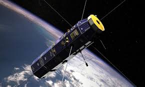
Satellite data sets consist of information collected by satellites orbiting the Earth, which capture a range of data from imagery to scientific measurements. These data sets provide high-resolution insights into various aspects of the Earth’s surface and atmosphere, often in real time.
Key Sources of Satellite Data
- Earth Observation Satellites: Capture images and data reflecting land use, vegetation, urban development, and environmental changes.
- Weather Satellites: Monitor atmospheric conditions, temperature, and weather patterns to aid in forecasting.
- Communication Satellites: Collect data related to global communications traffic and broadcasting.
- Navigation Satellites: Provide geospatial positioning data for GPS and other global navigation systems.
Benefits of Satellite Data Sets
Enhanced Environmental Monitoring
Satellite data is crucial for monitoring environmental changes, including deforestation, desertification, and the effects of climate change, enabling timely and effective responses.
Improved Disaster Response and Management
Real-time data from satellites can significantly improve disaster response efforts by providing accurate assessments of affected areas, aiding in effective resource deployment.
Advanced Urban Planning
Urban planners use satellite imagery to monitor and plan city growth, infrastructure development, and land use with greater precision.
Optimized Agricultural Practices
Farmers and agricultural companies use satellite data to monitor crop health, optimize irrigation practices, and improve yield forecasts.
Challenges in Utilizing Satellite Data Sets
High Costs
Launching satellites and maintaining satellite operations involve significant investment, making high-quality satellite data often expensive to acquire.
Technical Complexity
Processing and interpreting satellite data require advanced technical expertise and robust analytical tools.
Data Volume and Management
Handling the vast amounts of data generated by satellites poses significant challenges in terms of data storage, processing, and analysis.
Case Studies
A notable example is the use of satellite data by environmental agencies to track and combat illegal logging and mining activities. Another case is urban planners in large cities using satellite imagery to optimize traffic flow and public transport systems based on dynamic population density maps.
Future of Satellite Data Sets
As satellite technology advances and becomes more cost-effective, the accessibility of satellite data is expected to increase. This will likely lead to broader applications in commercial sectors and by smaller entities, further democratizing the data and expanding its use.
Extract Alpha
Extract Alpha datasets and signals are used by hedge funds and asset management firms managing more than $1.5 trillion in assets in the U.S., EMEA, and the Asia Pacific. We work with quants, data specialists, and asset managers across the financial services industry.
Conclusion
Satellite data sets are indispensable in today’s data-driven world, offering unmatched perspectives that inform decision-making across various fields. As we continue to advance our capabilities in satellite technology and data analysis, the potential for innovative applications and solutions will expand dramatically.
Commonly Asked Questions by Industry Professionals
- How can businesses start utilizing satellite data?
- Businesses can begin by partnering with satellite data providers and integrating satellite imagery and analytics into their existing data systems.
- What are the best practices for analyzing satellite data?
- Incorporating advanced image processing and machine learning techniques to extract actionable insights and continuously updating analytical models to adapt to new data are crucial practices.
- Can satellite data be integrated with other data sources?
- Yes, integrating satellite data with ground-based observations and other data sources can enhance the accuracy and applicability of the insights gained.
- What tools are necessary for processing satellite data?
- Specialized software for geospatial analysis, such as GIS platforms, and tools capable of handling large data sets are necessary.
- How do advancements in satellite technology affect data quality?
- Improvements in satellite technology, such as higher resolution sensors and faster data transmission, directly enhance the quality and utility of the data collected.